

Surveying is a branch of civil engineering that determines the relative position of points on the earth. It is the primary process to be done to before planning a new project. The main objective of surveying is to determine the direction, horizontal distance, elevation, areas etc to draft layouts at a predetermined scale. The surveying process consists of different methods like reconnaissance, measurement, marking and plan preparation. Moreover, the measurements require high possible accuracy. To analyse and calculate the field data, the surveyor should possess good mathematical skills. In this article, we are going to deal with the classification of Surveying.
Classification of surveying
Surveying is classified based on a lot of factors as listed below.
- Primary classification of surveying
- Classification of surveying based on field nature
- Classification of surveying based on purpose
- Based on Instruments classification of surveying
Also Read : Principle of surveying – First and second principle
Also Read : Augmented Reality in construction
The details of every classification basis is explained in detail in this article
Primary classification of surveying
The primary classification is based on the earth’s surface. We know earth is an oblate spheroid. So while surveying we must consider the earth as either plane or as curved. Primarily we can divide surveying into two types and are as follows.
Plane surveying
For plane table surveying the earth’s surface is considered as a plane. Therefore we should neglect the corrections due to earth curvature. So the line which connects these points are straight lines and the triangles made by joining these lines are Plane triangles. This type of surveying is useful for limited areas. ie less than 200 sq.m.
Geodetic surveying
In Geodetic surveying, the earth’s surface is considered as a curve. So the line which connects these points are curves and the triangles made joining these lines are Spherical triangles. Geodetic surveying is used for large areas of more than 200 sq.m.
Classification of surveying based on field nature
Land surveying
Land surveying is the art of establishing or re-establishing corners, lines, boundaries, and monuments of property/land based upon recorded documents, historical evidence, and present standards of practice. It helps in preparation of topographical maps, planning, and estimation of project works, locating boundary lines, etc. Land surveying is classified into three types.
- Topographical surveying
- Cadastral Surveying
- City surveying
Topographical surveying
The main application of a topographical survey is the drafting of maps. Topographical surveys include surveying natural and artificial features such as rivers, hills, roads, canals, etc. It consists of horizontal, vertical, and angular measurements. The scale range is 1: 25000 to 1: 1000000.
Cadastral surveying
The main use of this surveying is in the documentation process while transferring ownership from one person to another. It helps in defining the boundaries and land area calculations. It also called Public land survey.
City surveying
City surveying provides information for the construction of water supplies, sewage lines etc.
Hydro-graphic surveying
Hydro-graphic surveying deals with the surveying of water bodies. They help in offshore construction activities. Hydro-graphic surveying is also known as Marine surveying. It helps in determining the mean sea level calculation, water depth calculation, dredging analysis, etc.
Astronomical surveying
This type of surveying observes the heavenly bodies such as the sun, moon, stars etc to locate the absolute location and lines on the surface of the earth. It also determines the azimuth, latitude, longitude, and time.

Classification of surveying based on purpose
Engineering survey
This type of surveying helps to analyse the field data for engineering works such as the construction of roads, railways, sewage pipelines etc.
Military survey
This type of surveying helps the military services like the army, navy etc to determine the location of strategic importance. Through this surveying, we can provide maps of broader areas. Since it uses advanced technologies like remote sensing, GIS and GPS, we get precise field details.
Mining surveying
A mining survey determines the location of points in the underground for mine planning.
Geological survey
Gological survey helps in the study of earth composition. It helps to determine the arrangement of different strata on the earth.
Archaeological survey
This type of survey gives the details about old antiquity, forts etc to understand the archaeological sites.
Classification of surveying based on instruments
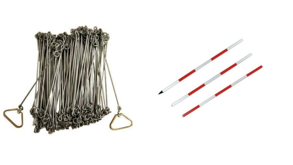
Chain surveying
Chain surveying is the simplest form of surveying. The principle of chain surveying is triangulation. In this surveying method, we only measure linear measurements. Also, it is suitable for small areas. The areas are divided into triangles and the sides of the triangles are measured. The chain surveying uses instruments such as chains, arrows, pegs, ranging rods, etc.
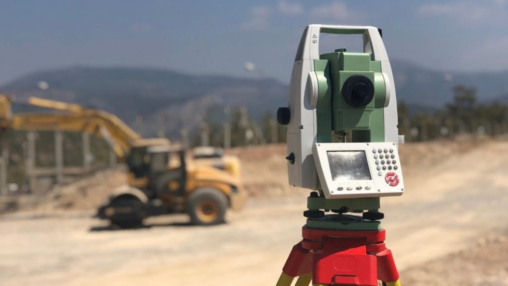
Theodolite surveying
Theodolite is a surveying instrument that measures horizontal and vertical angles. It is one of the precise methods of surveying. This type of surveying helps to find the level difference, setting out, prolonging survey lines, etc of the area.
Also Read : Total station – Principles and fundamentals
Traverse survey
Traverse surveying is a type of surveying in which we connect the survey lines to form a framework. The length can be measured either using the directly or indirectly method. So for the direct method of measurement, we use tapes and for the indirect method, we use Electronic Distance measurement Some important traversing methods are Chain traversing, Chain and compass traversing, Tape traversing and plane table traversing.
Triangulation survey
In triangulation surveying, we trace series of triangles formed by joining the survey points. The distance and relative points are calculated by the trigonometric relations between the length and angles of the triangle. It is preferable for hills and undulating areas.
Tacheometric survey
Taacheometric surveying is angular surveying in which horizontal and vertical distance are calculated from the angular measurements. It is a convenient surveying method. Tacheometric surveying uses transit theodolite with a stadia diaphragm for taking measurements. This method is preferable when a direct method of surveying is not possible.
Plane table survey
Plane table surveying is one of the fastest methods of surveying. It is a graphical method in which we can do field observation and plot simultaneously. Mostly preferable in magnetic areas where compass surveying is not possible. Also, we can check errors and mistakes using check lines. The instruments for plane table surveying are plane table, alidade, plumbing fork, plumb bob, spirit level, compass, etc.
Photogrammetric survey
It is a surveying type that uses photographs for making measurements. We can prepare maps, 3d diagrams from these photographs. These are mostly to study the wide life and to make virtual models of historical structures. Photogrammetric surveys cover a large area for surveying and they are less time-consuming.
Comments are closed.