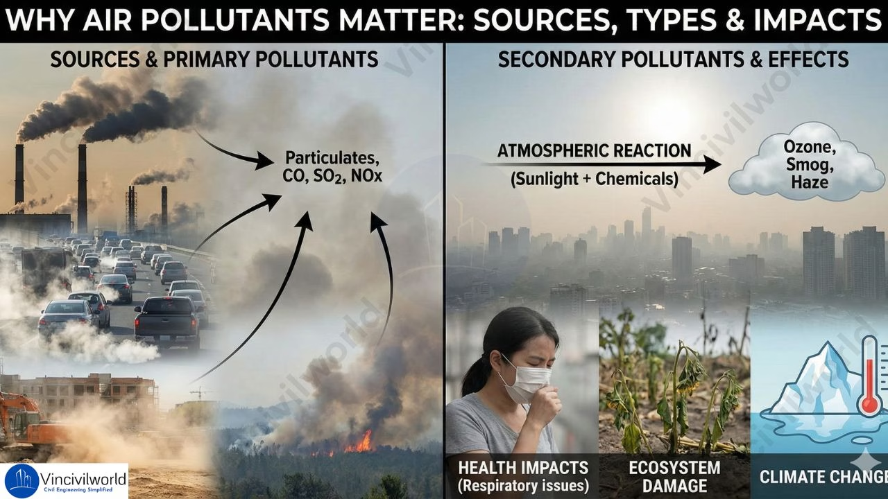
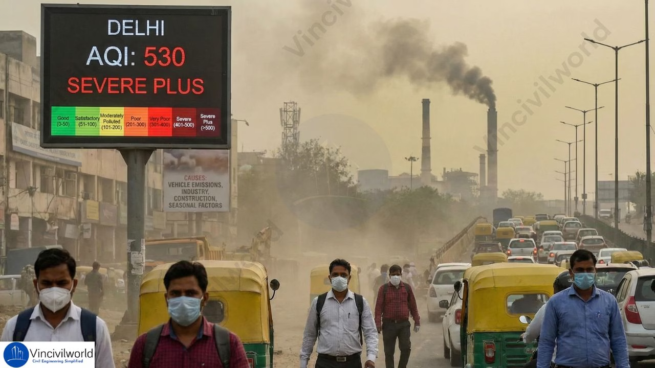
Air Pollution meteorology deals with the meteorological processes near to the earth’s surface. This consist of the impacts of meteorology on air pollutants and the effects of pollutants on meteorology. Air pollution meteorology studies how meteorological conditions affect the dispersion and behavior of pollutants. This field is crucial for understanding how various plume types—such as buoyant, neutral, and dense—interact with atmospheric conditions.
By analyzing air pollution meteorology, we can better grasp how factors like wind patterns, temperature inversions, and humidity influence plume behavior and air quality. Understanding these interactions helps predict pollution dispersion and mitigate its impact on health and the environment. With insights into types of plumes and their behavior, we can develop more effective strategies for managing and reducing air pollution.
In this blog, we will show you some important terms related to air pollution meteorology, air pollutant dispersion and meteorology, environmental stability and types of plumes.
Table of contents
Significance of air pollution Meteorology
If the air is still and pollutants are unable to disperse, the local concentration of air pollutants will rise. Strong, turbulent winds, on the other hand, remove air pollutants fast, resulting in reduced pollutant concentrations. Thus, the destiny of air pollutants is influenced by air movements and air pollutant dispersion. As a result, any study of air pollution should also include a look at the weather patterns in the area, that is meteorology. Meteorology plays a crucial role in understanding air pollutant dispersion because it helps explain how air movements affect the spread and concentration of pollutants in the environment.
The following are some of the benefits of analyzing air pollutant dispersion and meteorology data:
- Identify the source of pollution.
- Predict the occurrence of inversions and days with high pollutant concentrations.
- Simulate and predict air quality with the help of computer models.
Meteorological Factors affecting Air Pollution
Meteorological factors significantly influence air pollution meteorology by affecting plume behavior and dispersion. Wind speed and direction determine how different types of plumes—such as buoyant or dense—spread behave. Temperature inversions can trap pollutants, altering plume types and intensifying air pollution. Humidity and atmospheric pressure also impact the dispersion and behavior of pollutants, influencing overall air quality.
The following factors should be measured while examining air quality. They can help us better understand the chemical reactions that take place in the atmosphere.
- Wind speed and direction
- Temperature
- Humidity
- Rainfall
- Solar Radiation
Also read : Air Pollution Causes – A Comprehensive Guide

Wind speed and direction due to air pollution
Wind data records can be used to estimate the general direction and range of emissions when high pollutant concentrations occur at a monitoring station. Identifying the sources allows for the creation of a plan to decrease the negative effects on air quality.
In air pollution meteorology, wind speed and direction are crucial for plume behavior. High wind speeds can disperse pollutants widely. This affects various types of plumes. Calm conditions may lead to plume stagnation and localized air pollution. Understanding these factors helps predict air quality changes.

Temperature in plume behaviour
Temperature measurement aids in the assessment, modelling, and forecasting of air quality. The chemical processes that occur in the atmosphere to generate photochemical smog from other pollutants are influenced by temperature and sunlight (solar radiation).
Temperature influences air pollution meteorology by affecting plume behavior. Higher temperatures can enhance plume rise, dispersing pollutants more effectively. Conversely, temperature inversions trap pollutants near the ground, altering plume types and intensifying air pollution. Temperature variations thus play a key role in determining pollutant dispersion patterns.
Humidity affecting air pollution meteorology and plumes
Water vapour plays a key role in a variety of thermal and photochemical reactions in the atmosphere. They can dramatically raise the amount of light scattered by particles suspended in the air if they are bound to particles . If corrosive gases, such as sulphur dioxide, bond to water molecules, the gas will dissolve in the water and generate an acid solution that can harm people and property.
Humidity impacts air pollution meteorology by affecting the size and behavior of pollutant plumes. High humidity can lead to the formation of secondary pollutants. It can also alter plume types. Low humidity may enhance pollutant dispersion. Understanding humidity’s role is essential for accurate air quality assessments.
Rainfall affecting air pollution meteorology
When the rain washes particulate matter out of the atmosphere and dissolves gaseous contaminants, it has a scavenging effect. Visibility is improved by removing particulates. Also, when there is a lot of rain, the air quality is usually improved. Acid rain can arise when rain dissolves gaseous pollutants like sulphur dioxide, causing possible damage to objects and plant.
Rainfall affects air pollution meteorology by removing pollutants from the atmosphere through washout processes. It can change plume behavior, reducing pollutant concentrations in the air. The type and intensity of rainfall influence plume behavior. This impacts overall air quality and pollution levels.
Solar Radiation in air pollution meteorology
Solar radiation must be monitored for use in modelling photochemical smog occurrences because the intensity of sunlight has a significant impact on the rate of chemical reactions that form smog. The intensity of sunlight is affected by cloudiness in the sky, time of day, and geographic location.
Solar radiation influences air pollution meteorology by driving chemical reactions in the atmosphere. It affects plume behavior by promoting the formation of secondary pollutants and influencing thermal patterns that impact plume types. Solar radiation’s role is crucial in understanding how different types of plumes disperse and interact with the environment.
Lapse Rate in Air Pollution Meteorology
The rate of change in the measured temperature as we move up through the Earth’s atmosphere is known as the lapse rate.
- When the temperature drops with elevation, the lapse rate is positive.
- It is zero when the temperature remains constant with elevation.
- When the temperature rises with elevation the adiabatic lapse rate is negative. This is called temperature inversion.
Environmental Lapse Rate
The rate of decrease of temperature with altitude in the stationary atmosphere at a given time and location is known as the environmental lapse rate (ELR). The International Civil Aviation Organization (ICAO) has defined an international standard atmosphere (ISA) with a temperature lapse rate of 6.49 K/km (1.98 °C/1,000 ft) from sea level to 11 km.
(dT/dz)env = -6.5 K / 1000 metres
The environmental lapse rate in air pollution meteorology affects plume behavior. It influences how different types of plumes rise or stay grounded. This impacts the dispersion and concentration of pollutants.
Adiabatic Lapse Rate
The adiabatic lapse rate (ALR) refers to the rate with which the temperature of an air parcel changes in response to compression or expansion associated with elevation change. This process is assumed to be adiabatic, that is, no heat exchange happens in between given air parcel and its surrounding.
(dT/dz)adia = -g/Cp = -9.86 0C / 1000 metres
Where,
g = acceleration due to gravity
Cp = Specific heat at constant pressure
The adiabatic lapse rate in air pollution meteorology defines how temperature changes with altitude for rising or descending plumes. This influences plume types and their dispersion characteristics and behavior.
Atmospheric Stability
The degree of atmospheric stability plays a key role in the ability of atmosphere to disperse the pollutants emitted to it. It is determined by comparing ELR and ALR.
When ELR = ALR, the atmosphere is neutrally stable.
If ELR > ALR, the atmosphere is superadiabatic and unstable.
When ELR < ALR, the atmosphere is subadiabatic and stable.
Under an unstable atmospheric condition, the lapse rate is super adiabatic. The actual temperature gradient is more negative than the dry adiabatic temperature gradient. A rising parcel of air gets warmer and tends to travel upwards due to increasing buoyancy. Air from different altitudes mixes thoroughly. There is rapid dispersion of pollutants throughout the entire atmosphere. As a result, this is highly desirable in pollution prevention.
Under a stable atmospheric condition, the lapse rate is subadiabatic. In this condition, a rising parcel of air gets denser, cooler and tends to fall back. The vertical mixing is very less and the dispersion of pollutants is very slow.
Atmospheric stability in air pollution meteorology determines how air layers resist or promote vertical movement. This affects plume types and behavior. It also influences the dispersion and mixing of pollutants.
Types of pollution Plumes
A plume is a column of liquid, gas, or dust that moves through another fluid, gas, or dust. The term plume is commonly used to describe things like smoke rising from a chimney. Depending on the degree of atmospherical instability, exit velocity from a stack and the prevailing wind turbulence, the plume emitted from a stack behave in different ways.
In air pollution meteorology, plume types refer to the behavior of pollutant emissions as they disperse in the atmosphere. Each plume type exhibits distinct behavior based on meteorological conditions, influencing how pollutants spread and affect air quality. Common types of plumes include….
- Coning Plume
- Fanning Plume
- Looping Plume
- Lofting Plume
- Fumigating Plume
- Trapping Plume
Let’s have a look at each one of them.


Coning Plume types
In air pollution meteorology, a coning plume occurs when pollutant emissions disperse in a vertical cone shape. This plume type typically forms under neutral atmospheric conditions, where temperature and wind speed are relatively consistent with height. The coning plume’s symmetrical spread limits its horizontal dispersion, keeping pollutants concentrated near the emission source. Understanding this plume behaviour is crucial for predicting pollutant distribution in various meteorological scenarios, influencing air quality management strategies.
- Formed when horizontal wind velocity exceeds 32 km/h and cloud blocks solar radiation during the day and terrestrial radiation during the night.
- There is little vertical mixing.
- The environment is slightly stable under sub-adiabatic conditions (ELR<ALR).
- The plume shape is vertically symmetrical about the plume line.
Fanning Plume types
In air pollution meteorology, a fanning plume occurs under stable atmospheric conditions. This happens where the environmental lapse rate is less than the adiabatic lapse rate.

- Formed at extreme inversion conditions owing to a negative lapse rate.
- When the environment is under conditions of inversion, a stable environment occurs just above the stack, and the plume moves horizontally rather than upwards.
- Occurs more frequently when there is less turbulence.
- For high stack, fanning is considered a favourable meteorological condition as it doesn’t cause ground pollution.
Looping Plume types
In air pollution meteorology, a looping plume forms under highly unstable conditions. The plume rises and falls. This leads to erratic pollutant dispersion.

- The wavy looping plume arises in a super adiabatic environment (ELR>ALR). This results in a very unstable atmosphere due to rapid mixing.
- In an unstable atmosphere, rapid vertical air motions occur both upward and downward, resulting in a looping plume.
- As a result, large pollution concentrations may arise near the ground.
- It is preferable to create high stacks where the environment is normally hyper adiabatic to scatter these contaminants.
Neutral Plume types
In air pollution meteorology, a neutral plume occurs in neutral atmospheric conditions. In these conditions, plume behaviour is neither buoyant nor sinking. It maintains a steady dispersion.
- In neutral atmospheric circumstances (ELR=ALR), a neutral plume forms.
- A neutral plume rises vertically in an upward direction.
- The plume will continue to rise until it reaches a height where the density and temperature of the surrounding air are equal.
Lofting Plume types
In air pollution meteorology, a lofting plume rises above a stable layer of air, enhancing dispersion. This plume type benefits from favorable plume behavior for pollutant spread.
- Lofting plume is produced by a strong super adiabatic lapse rate immediately above the stack and a negative lapse rate (inversion) immediately below the stack opening.
- The downward movement is stopped by inversion.
- This results in a very rapid and turbulent upward mixing of the plume. But the downward mixing is less.
- As a result, the dispersion of pollutants becomes quick, and pollutants cannot come down to the ground.
- Such a plume is good for dispersing air contaminants and providing significant protection to living beings.
Fumigating Plume
In air pollution meteorology, a fumigating plume descends from an inversion layer. This descent causes pollutants to concentrate near the ground. This illustrates adverse plume behavior.
- The fumigant plume is the exact opposite of the lofting plume.
- Formed when there is a negative lapse rate (inversion) just above the stack and a strong super adiabatic lapse rate below the stack.
- Pollutants cannot escape above the stack under these conditions, thus they settle towards the ground due to turbulence and mixing.
- As a result, the dispersion of contaminants in a fumigant plume is exceedingly poor.
Trapping Plume
In air pollution meteorology, a trapping plume occurs between two inversion layers. It confines pollutants within a specific altitude. This showcases a critical plume behavior.
- When an inversion layer exists above and below the stack, the plume does not rise or fall.
- Rather, it is constrained or trapped between the two inversion levels, resulting in a trapping plume.
- This plume isn’t optimal for pollution dispersion since it can’t go past a particular height.
Key Takeaways
- Air Pollution Meteorology: Examines how meteorological conditions like wind, temperature, and humidity influence pollutant dispersion and plume behavior.
- Types of Plume: Include Coning, Fanning, Looping, Lofting, Fumigating, and Trapping, each behaving differently based on atmospheric stability.
- Plume Behavior: Influenced by factors such as wind speed. Temperature inversions and atmospheric pressure also play a role. These factors determine how pollutants spread and affect air quality.
- Environmental Stability: Plays a critical role in how plumes rise, disperse, or remain trapped, impacting overall pollution levels.
- Meteorological Analysis: Helps predict and mitigate pollution impacts by understanding plume dynamics under varying weather conditions.
Conclusion
Understanding Air Pollution Meteorology is essential for managing and reducing pollution’s impact on the environment and health. By analyzing the Types of Plume and their behavior, we can predict how pollutants will disperse under different meteorological conditions. The interaction between Plume Types and factors like wind, temperature, and atmospheric stability determines air quality outcomes. Effective strategies for pollution control rely on insights into Plume Behavior, enabling us to mitigate the adverse effects of air pollution. This knowledge is crucial for developing sustainable solutions to manage air quality and protect public health.


